


August 26, 2011
— Open Blogger Good evening, Morons and Moronettes, and hello from the Moron Central Weather Desk. It looks like we may have some good news for once, but there is still danger for the Eastern Seaboard... here are the quick hits.
1) The expected strengthening of Irene did not happen this afternoon, and the storm currently has maximum sustained winds of 100 mph, making it a strong Category 2 storm. We had anticipated it strengthening to a Category 3 storm, so this is a good development. With that said...
2) The track seems to be firming up, having the center of circulation crossing the eastern point of North Carolina and hugging the coasts of Maryland, Delaware, and New Jersey before entering New England somewhere fairly close to New York City, most likely as a Category 1 hurricane.
Thanks, as ever, to wunderground.com.
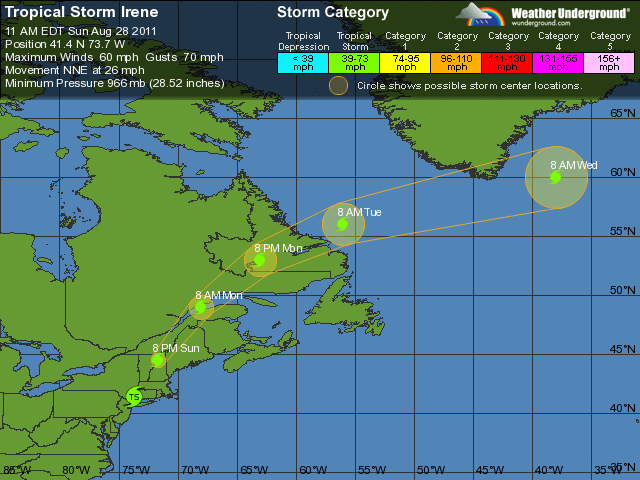
As the above graphic indicates, tomorrow is going to be a rough ride for North Carolina, Virginia, Maryland, and Delaware. The thing I'd like to point out is that this system is 600-700 miles in diameter, so it's going to affect a large area.
Near Norfolk, the Portsmouth Naval Facility on the Elizabeth River is anticipating a high tide at 8:20 AM... and then again around 8:03 or so that night, which is when the center of circulation is anticipated to make its closest approach to Norfolk. That's not horrible, but we are talking about seas of 10-13 feet until after midnight. So let's stay away from the water... again, most people are killed by flooding or by being stupid enough to stand too close to the seas while the waves are rocking. Don't naturally select yourself.
I don't anticipate that this storm is going to behave perfectly (it hasn't so far, so why should it start now?), but if you're near DC, Wilmington, or Philadelphia, you should have a fairly rainy and windy time starting Saturday and into Sunday. You can expect higher seas on the coast, but you should be on the comparatively safer west side of the storm.
Finally, let's talk about the impacts in and around New York City. If it continues on the forecast track, the center of circulation may cross directly over NYC. I don't anticipate that it's going to behave, however, so take that with a grain of salt.
Now let's take the cautionary part- even if it slips down below hurricane strength (75 mph sustained winds), it's still going to be driving a ton of water with it. Even though Katrina, for example, only came ashore with winds of a strong Category 3 storm, she was pushing water consistent with that of a Category 5 storm. It's a question of inertia- once you suck up a bunch of water, it has to go somewhere, and it's going to keep moving in the direction it was going in the first place. Take this seriously- don't let your guard down in Boston, Providence, or ANYWHERE near Long Island Sound.
The northeast side of the storm is traditionally where the really weird stuff happens, like embedded tornadoes... if you're in the path of this storm, you need to pay close attention to any tornado watches that go up. The really scary thing about hurricane-embedded tornadoes is that, while they're not usually very strong, they're usually rain-wrapped, and therefore really hard to see. So, that means that if you're in CT, RI, MA, NH, or ME, you're going to need to stay informed as the storm transits your area.
So let's talk, finally, about impacts... I doubt this thing is going to be the cataclysm we thought it was going to be if it had undergone its major strengthening today. It's going to be a serious flooding problem for low-lying and coastal areas, and there will be some wind damage, probably in NC and VA, and in the path of the center of circulation, but it is extremely unlikely to resemble the coming Zombie Apocalypse or the Rampaging Hobo Stampede.
Drew put it perfectly on Twitter earlier today- because this thing isn't going to utterly wipe out NYC, one would have to figure that New Yorkers will now cheerfully ignore any future weather warnings. Because of the lack of frequency of hurricane encounters in NY, that's not entirely unfounded. I would just point out that in New Orleans, it was all fun and games from 1969 until 2005. Then... oh yeah, hurricanes are still dangerous.
If you've moved out of the way of the storm, please stay there- again, power will likely still go out, emergency services will be spotty at best, and businesses will likely not be open through the weekend. It's an expensive pain in the ass, but one of the other things that happens in hurricanes is that the lack of people on the street makes it easier for the local PD to pick out the bad guys. It's easier on the emergency management people if there are fewer people around until after the storm has passed.
Okay, that's it for tonight... we'll keep you posted on developments here as they happen. Be safe!
-tmi3rd
Posted by: Open Blogger at
07:45 PM
| Comments (65)
Post contains 865 words, total size 5 kb.
Posted by: CDR M at August 26, 2011 07:52 PM (Ybl9g)
Posted by: tmi3rd at August 26, 2011 07:55 PM (WRtsc)
Posted by: helofixer at August 26, 2011 07:57 PM (V3fxx)
Posted by: CDR M at August 26, 2011 07:58 PM (Ybl9g)
Posted by: JBiden at August 26, 2011 07:58 PM (LJAdd)
Posted by: tmi3rd at August 26, 2011 07:59 PM (WRtsc)
Posted by: owlpellets at August 26, 2011 07:59 PM (P9Fq6)
Posted by: tmi3rd at August 26, 2011 08:00 PM (WRtsc)
Posted by: CDR M at August 26, 2011 08:00 PM (Ybl9g)
Posted by: owlpellets at August 26, 2011 11:59 PM
You comment same twice You pay twice..
Posted by: Comment Porice at August 26, 2011 08:01 PM (ZUWaD)
Posted by: tmi3rd at August 26, 2011 08:02 PM (WRtsc)
We are certainly awaiting Bami's exit plan for Philadelphia... what, it's the same as his economic plan?... get everyone to move to Texas?
Posted by: phreshone at August 26, 2011 08:02 PM (T3vCe)
Posted by: CDR M at August 26, 2011 08:03 PM (Ybl9g)
Posted by: tmi3rd at August 26, 2011 08:04 PM (WRtsc)
Posted by: owlpellets at August 26, 2011 11:59 PM (P9Fq6)
WHAT ABOUT THE BABIES!!! OH THE HUMANITY
Posted by: Geraldo at August 26, 2011 08:04 PM (M8yfa)
Posted by: owlpellets at August 26, 2011 08:05 PM (P9Fq6)
Posted by: The Dude at August 26, 2011 08:05 PM (M8yfa)
Posted by: CDR M at August 27, 2011 12:03 AM
If they're Volts I get checks...
Posted by: Hurricane Irene at August 26, 2011 08:05 PM (ZUWaD)
Posted by: CDR M at August 26, 2011 08:06 PM (Ybl9g)
Posted by: helofixer at August 26, 2011 08:08 PM (V3fxx)
Posted by: Taxpayer at August 26, 2011 08:08 PM (NpmCe)
Posted by: owlpellets at August 26, 2011 08:09 PM (P9Fq6)
Posted by: CDR M at August 26, 2011 08:09 PM (Ybl9g)
Hey Tmi, it looks like the eyewall has wrapped around the eye again and the cloudtops over the COC look real cold. You can see a pinhole eye with the Dvorak floater
My eye is dialated, picked up some weed over the Bahamas...
Posted by: Hurricane Irene at August 26, 2011 08:12 PM (ZUWaD)
The chances of a few tornadoes springing up will also be fairly high -- especially in Massachusetts -- if the eye makes landfall there, as currently predicted.
If you live in any of the above mentioned areas, batten down the hatches and put everything in, under cover on Saturday.
Posted by: Dell - Son Of Libertea at August 26, 2011 08:14 PM (3S10h)
Posted by: tmi3rd at August 26, 2011 08:15 PM (WRtsc)
Posted by: Future Hurricane Jose at August 26, 2011 08:16 PM (Ybl9g)
Posted by: Quilly Mammoth at August 26, 2011 08:16 PM (AWahI)
Posted by: CDR M at August 26, 2011 08:18 PM (Ybl9g)
Posted by: rockmom at August 26, 2011 08:18 PM (X/P6o)
tomorrow they are closing some parkways in Jersey going in one direction, they will all go away from the coast. NYC is probably closing some bridges tomorrow also.
Posted by: curious at August 26, 2011 08:24 PM (k1rwm)
Posted by: CDR M at August 26, 2011 08:29 PM (Ybl9g)
But #10 was really never very defined either.
Posted by: Quilly Mammoth at August 26, 2011 08:36 PM (AWahI)
People don't need to get too wrapped up in whether the winds have dropped by 10 mph. I mean, would you let a major league pitcher toss a fastball at your head if he slowed it down by 10 mph?
Posted by: As If! at August 26, 2011 08:37 PM (piMMO)
Irene is just as strong as was Katrina when it made landfall. I have photos of what it did to Mississippi. I've never seen anything like it in all my life. It was one of those rare instances that despite the dramatics, Shep Smith and Geraldo Rivera simply could not do it justice.
Posted by: As If! at August 26, 2011 08:41 PM (piMMO)
Curious, methinks the guy has had about two too many.
Posted by: As If! at August 26, 2011 08:44 PM (piMMO)
Posted by: rockmom at August 26, 2011 08:46 PM (X/P6o)
Posted by: slug at August 26, 2011 08:50 PM (cPuUo)
hahhaha that's true...but you know I find gutsy people like this are the ones who eventually bring out the greatness in the rest of us....
Posted by: curious at August 26, 2011 09:21 PM (k1rwm)
Irene is seven hundred miles in diameter. Dumping a lot of rain...and it is taking hours and hours to move past any single area. For example, it'll be over the N.C. coast for approx. twenty hours. Each stop up the coast will get similar treatment from this storm. Inland flooding, downed trees, flying debris, etc., etc.,
This might be one of those times when quantity has a quality all it's own.
Be careful out there.
Posted by: Warren Bonesteel at August 26, 2011 09:23 PM (E7Z1r)
Posted by: CDR M at August 26, 2011 09:33 PM (Ybl9g)
Posted by: MrCaniac at August 26, 2011 09:41 PM (eKuOw)
Posted by: Florida 2004 at August 26, 2011 10:32 PM (0pB27)
Posted by: Florida 2004 at August 27, 2011 02:32 AM (0pB27)
I went a week without power. And I'm in NE Florida.
Posted by: As If! at August 26, 2011 10:42 PM (piMMO)
It'll be about the same as the Dec 92 nor'easter. Not a gentle shower, but hardy "historic" or "like nothing seen before"
Posted by: kbdabear at August 26, 2011 10:52 PM (Y+DPZ)
Posted by: kbdabear at August 26, 2011 11:00 PM (Y+DPZ)
Posted by: NC Ref at August 27, 2011 12:04 AM (/izg2)
Great post. Thanks. Glad Irene got weaker, North Carolina. Y'all stay safe.
For those who prepared and escaped damage, count your blessings and realize you are ready for any other disaster ahead. That's what those of us Florida evacuees do, anyway. We have evacuated for five or six in our 27 years on the east coast. Hurricane Floyd was set to wipe this island off the map. I was so thankful to have a home to come back to I did not care about the hassle involved in leaving. Count your blessings and take care.
Posted by: ChristyBlinky at August 27, 2011 06:23 AM (fNdyx)
Posted by: steevy at August 27, 2011 11:43 AM (pV6cO)
Posted by: God, No! AudioBook at August 27, 2011 04:30 PM (K7myj)
Hide Comments | Add Comment | Refresh | Top
64 queries taking 0.1919 seconds, 193 records returned.
Powered by Minx 1.1.6c-pink.


Posted by: Joe Biden at August 26, 2011 07:51 PM (ZUWaD)